Duration:
(6.5 kilometers)
3 hours
Difficulty: 7/10. 386m elevation gain. Rating 7 instead of 5 because the down part after mount Cameron is steep and slippery. About 40% shaded.
Cel phone coverage: Everywhere.
Water needs: 1.5 liter
Transportation: Bus 6 from Central (Exchange Square), get off at Wong Nai Chung Reservoir Park. You will end your trek at Wan Chai MTR station.
Why it's worth it:

Exercise Area: Yes (Wan Chai gap)


---------------------------------------
 |
| Get off at 'Wong Nai Chung Reservoir Park', which is right next to the Sinopec station. You will see it coming and there are usually a lot of hikers getting off at this stop. |
 |
| Cross the road in front of you (Wong Nai Chung Gap road), there's a little path that goes by the stone stele. Then cross the road again to the bus stop. Then head left. |
 |
| Then, keep right on Deep Water Bay road for just about 50m... |
 |
| ... then head right unto Black's Link. You will see the sign of the Hong Kong Trail on your left |
 |
| Keep going on Black Link's road |
 |
| Eventually, the road narrows |
 |
| After about 20 minutes walk from the Sinopec station, and 1km, you will see the electrical pylon on your left, and, on your right, this is where you will start your climb of Mount Nicholson. The rock formation you see at the top of that hill is where the 'bird' and 'face' rocks are located. |

 |
| When you get to this point, the spiky rock is the bird's beak. |
 |
| Looking back at the 'bird. |


 |
| Once you are done with the rocks picture taking, keep going up the path towards the building which looks like something out of a James Bond movie... |
 |
| Walk by the concrete structure |
 |
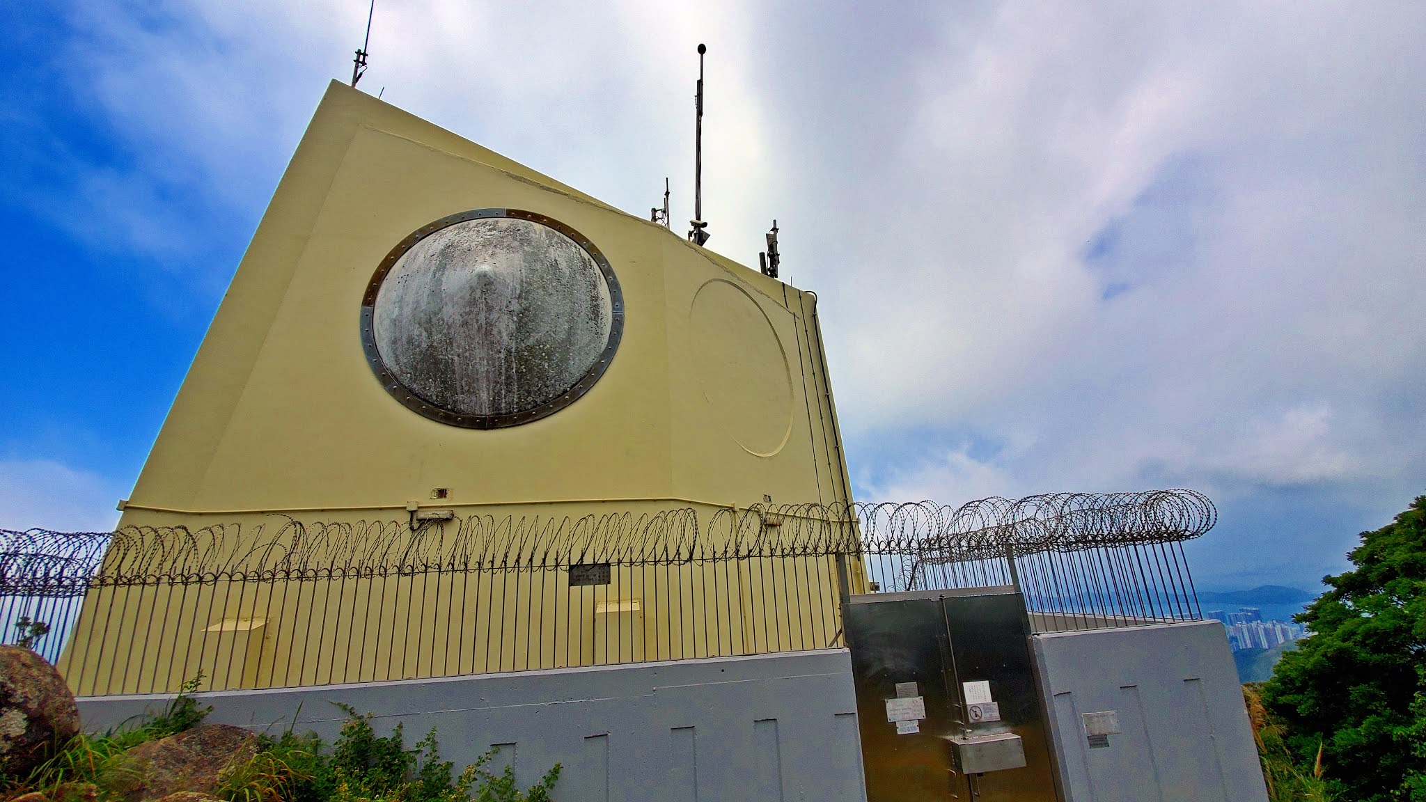
| ... then right after, you will see the James Bond villain's lair on your right (image below), and a path from the building, going down on your left. Take the path going down. |
 |
| Quite pretty... |

 |
| About 800m after the James Bond building, you will get back on the Hong Kong trail section 4 path. Head right |

 |
| After about 25 minutes on HK Trail section 4, you will see a pavilion on your left, and a sign post on your right. Take a left towards Aberdeen Reservoir... |
 |
| ... but just a few meters into that path, you will see stairs going up on your right. Ignore the warning sign and climb up. |
 |
| Right before the top of the stairs, you will see a dirt path going up on your left. Take that path. |

 |
| After another 400m or so, you will reach this fork in the path. Notice the trees that will make it relatively obvious. Head left. |
 |
| You have reached the top of Mount Cameron! Keep going straight and you will progressively go down. |
 |
| There is one obvious fork after 300m from the top of Mount Cameron. Take a right. Be careful afterwards as the path gets steep and very slippery. Hang-on to the trees. |
 |
| You will be reaching Middle Gap Road after about 25-30 minutes. Head right on Middle Gap Road. |
 |
| Then right again towards Wan Chai Gap |
 |
| Lots of huge mansions along Middle Gap Road |
 |
| You will eventually reach Stubbs Road. Cross it straight and go down Wan Chai Green Trail pedestrian path. All the way down to Wan Chai... |


 |
| Kennedy Road. Cross the street on the left. then go down the stairs that are by the yellow building... |

 |
| Cross Queen's road and keep going straight... |
 |
| ... through the market, and eventually, you will reach Johnston Road. The MTR entrance is on your right and across. |